
The Deep Canyon Insect Survey
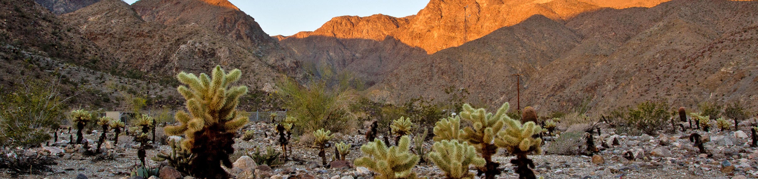
The P.L. Boyd Deep Canyon Desert Research Center was established in 1959, formally dedicated as a University of California Natural Reserve in 1970, and today consists of over 9,000 hectares (including some 2,500 hectares within the Reserve boundaries but not formally part of the Reserve). The Reserve is southeast of Palm Springs, at the base of the Santa Rosa and San Jacinto Mountains, with elevation ranging from 9 to 2,650 meters, and encompassing a wide range of habitat types. These include montane forest, chaparral, high desert plateau, pinyon-juniper woodland, rocky alluvial fans, sandy washes, steep rocky slopes, ephemeral streams, and permanent waterholes (Ting & Jennings, 1976). There is a considerable body of data and research on the climate, hydrology, plants, and animals within and surrounding the study area; a total list of over 200 publications to date. Included in this total are lists based on voucher collections of taxa, including over 600 vascular plant species (Zabriskie, 1979), over 300 vertebrates (Mayhew, 1983; Weathers, 1983), plus the largest such effort, the voucher collection of the arthropods of Deep Canyon. This collection was begun in 1963 by E.I. Schlinger and M.E. Irwin, and greatly expanded between 1978 and 1988 by S.I. Frommer, J.D. Pinto, and A. Tabet, most notably through the use of Malaise traps, ultimately capturing close to half a million insects, all deposited in the UCR Entomological Research Museum (ERM). The size and scope of this project proved to be well beyond the capacity of those who carried it out, but they were still able to process some 80,000 insect specimens and get expert identifications for some 50,000 of these, including several described as new taxa (thus, the collection includes hundreds of paratypes). Most of these specimens were given labels with unique identifying numbers, but only limited attempts were made to compile the label data. To date, the primary practical data product of this voucher collection has been its contribution to a species checklist listing over 2,500 invertebrate taxa from the study area (Frommer, 1988). Most importantly, the data on the specimens was not georeferenced, and thus not entirely compatible with other studies within the Reserve. Only in the last few years, since Doug Yanega's (the Senior Museum Scientist) creation of the ERM's specimen-level database in 1999, have any of the Deep Canyon vouchers had their data captured and georeferenced (through combined use of maps and GPS units), but this effort has been only piecemeal, as the ERM's databasing protocol presently only involves new material or material being sent out on loan.
In January of 2003, a collaborative effort between UCR's Center for Conservation Biology and the California Department of Fish & Game resulted in an attempt to rectify this situation by hiring data entry technicians whose sole responsibility is to capture data from the Deep Canyon voucher collection. As the specimens are housed in the ERM, these technicians visit and work there, supervised by Dr. Yanega. Allowing for additional identifications that should occur within this time span, the estimate is that roughly 60,000 records should be entered if funding continues until the project is completed.
The end product of this effort is a database that contains the detailed taxonomic data (from Order to genus and/or species) for each specimen, in addition to date, georeferenced locality, and plant associations, if any. Users of this database will thus be given access to a copious amount of data on the spatial and temporal distributions of the various taxa represented. This databasing effort completed capturing data for approximately half of the identified specimens before the funds were exhausted, resulting in nearly 24,000 records. Those records are incorporated into the ERM's main database of nearly 600,000 records (as of 2021), of which over 200,000 are accessible (including all of the Deep Canyon records) via the DiscoverLife data portal, and the SCAN data portal.
The digitisation of date and georeferenced locality records will finally allow users of the database to cross-reference the results of the arthropod survey with the extensive data archives for other features within the Deep Canyon Reserve; these include comprehensive herbarium and vertebrate collections, data from 6 weather stations, aerial and ground-based photographic monitoring, and maps. Much of this data has been collected with reference to the standardized "Deep Canyon Transect" established in 1979, a belt transect some 34 km long and 19 km wide, including protected, relatively undisturbed examples of major Colorado Desert habitats; this study area has been further subdivided into over 30 smaller-scale permanent line transects, as well as numerous study plots, by various investigators, enabling effective long-term monitoring of the desert ecosystems in the area. The eventual integration of data from the voucher collection into this framework will thus represent a substantial improvement in our overall knowledge of the ecology of the Deep Canyon area.